The global AI market is experiencing rapid growth. It’s expected to increase at a rate of more than 36% every year through 2030. This illustrates how deeply AI is becoming integrated into everyday business operations. When location intelligence meets artificial intelligence, it creates real impact.
It makes workflow better and turns them into smart, data-driven strategies. This is something MapCopilot brings to Microsoft Dynamics 365 users like you through its seamless integration with Maplytics.
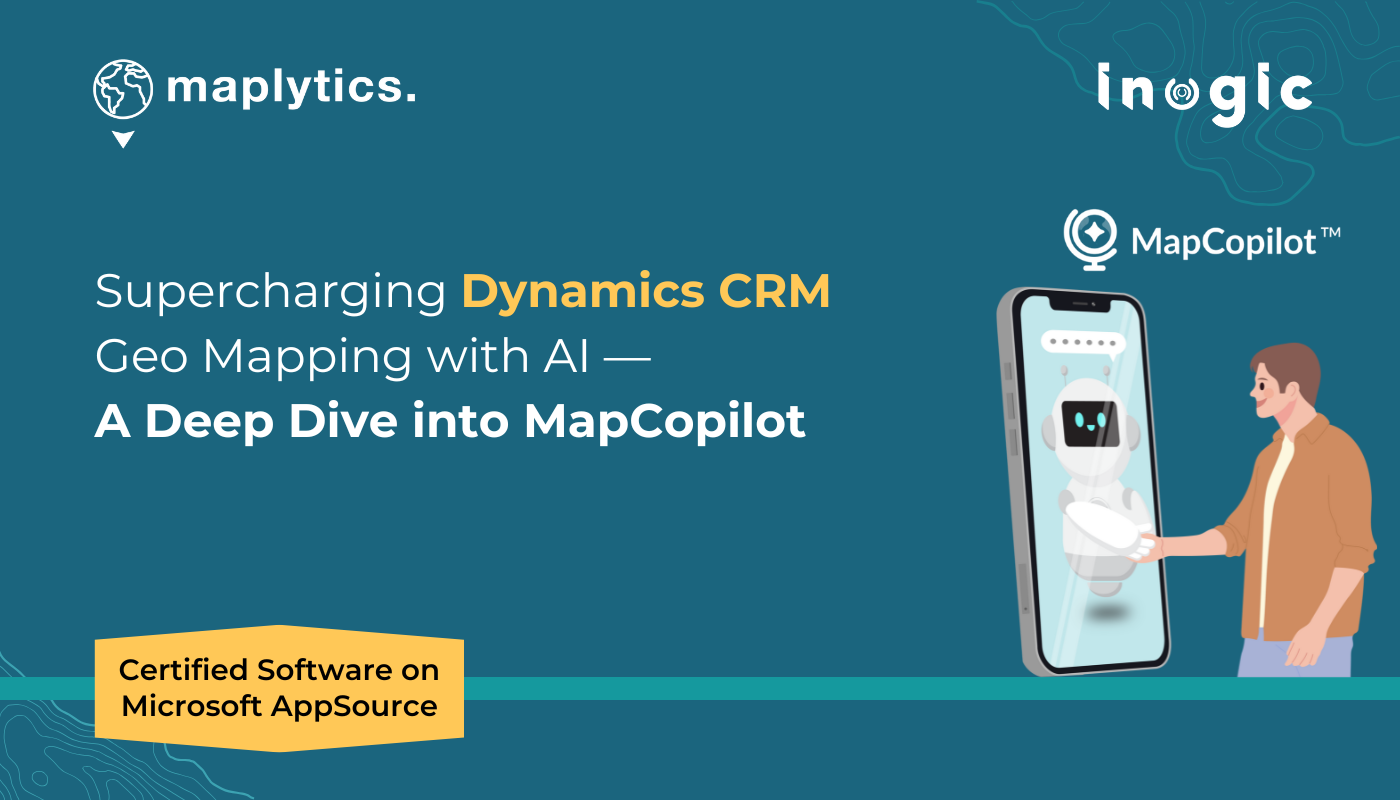
MapCopilot = Map + Copilot, an AI-driven search assistant that transforms how users interact with Dynamics CRM data within Maplytics. Instead of clicking through plot cards and filters while in a hurry, you can simply type or speak what they need. From plotting records to running proximity/radius searches to planning optimized routes, everything can happen through simple natural language prompts.
Why MapCopilot Matters
For most organizations, CRM data is constantly being utilized. Plotting data, filtering, setting proximity ranges, or optimizing routes are often time-consuming manual tasks. MapCopilot automates and simplifies these steps.
- Perfect for new users unfamiliar with plot cards.
- Reduces multiple manual clicks to a single prompt.
- Ensures accurate, quick outputs.
- Makes advanced mapping accessible to everyone, new and old.
By merging AI capabilities with location intelligence, MapCopilot gives businesses across industries and teams from sales to field service a real-time, intelligent mapping experience.
Configure MapCopilot
To set up MapCopilot, you need to import the Maplytics package into their system. An Azure Service subscription license is also required to process user queries/prompts. This subscription is included in the Maplytics package. You can add your own subscribed models as well to use MapCopilot. A user can also toggle between using their subscription and Maplytics’ default subscription.
Plotting Records in MapCopilot
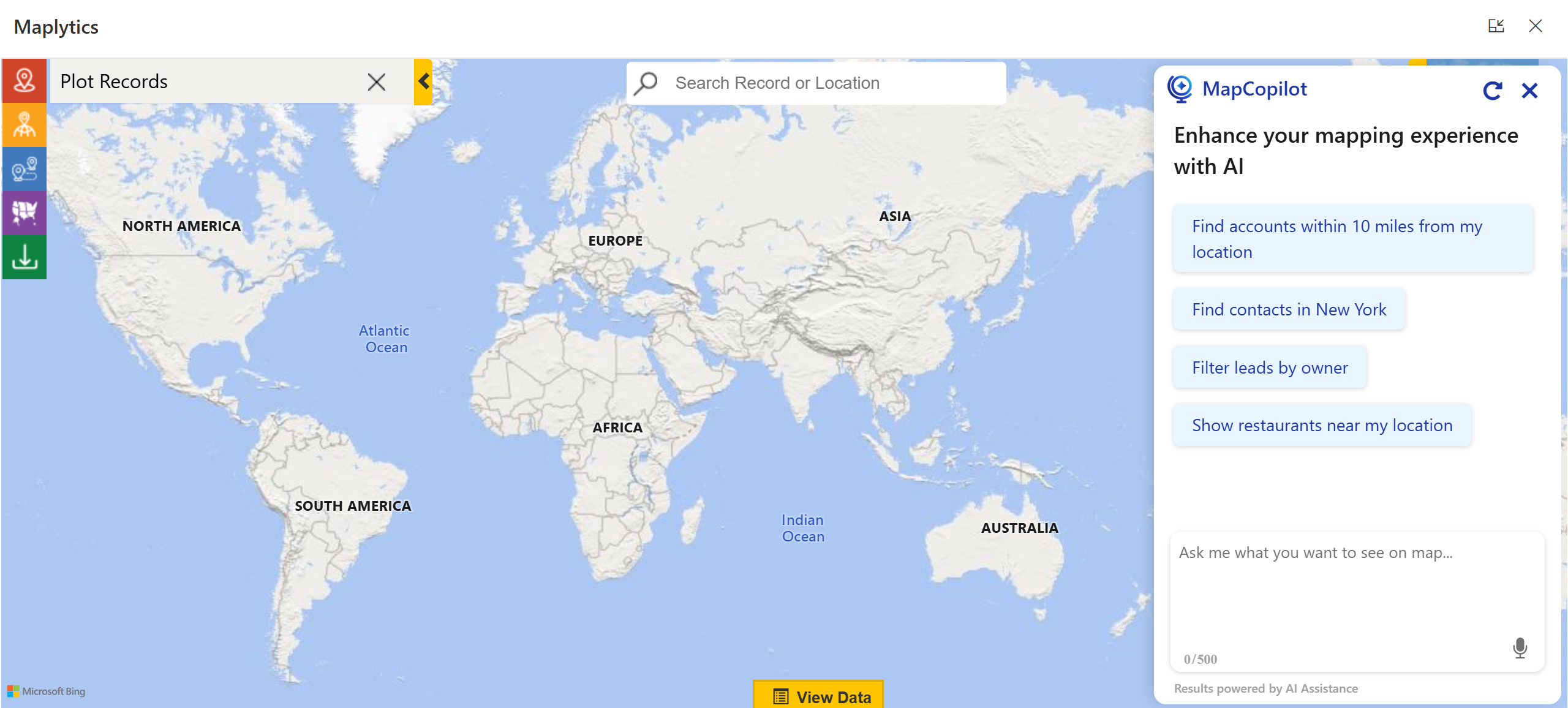
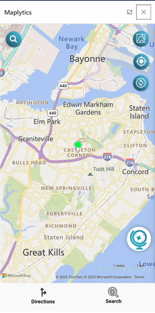
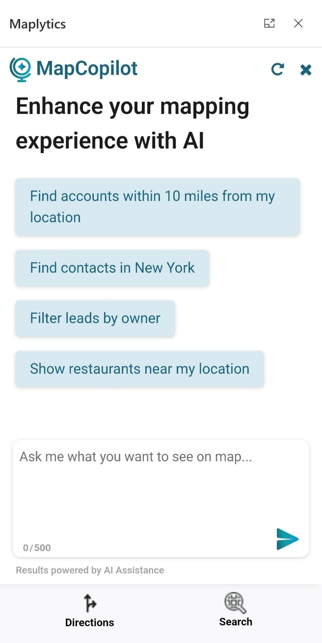
You can access MapCopilot by clicking on its icon on the Detail Map.
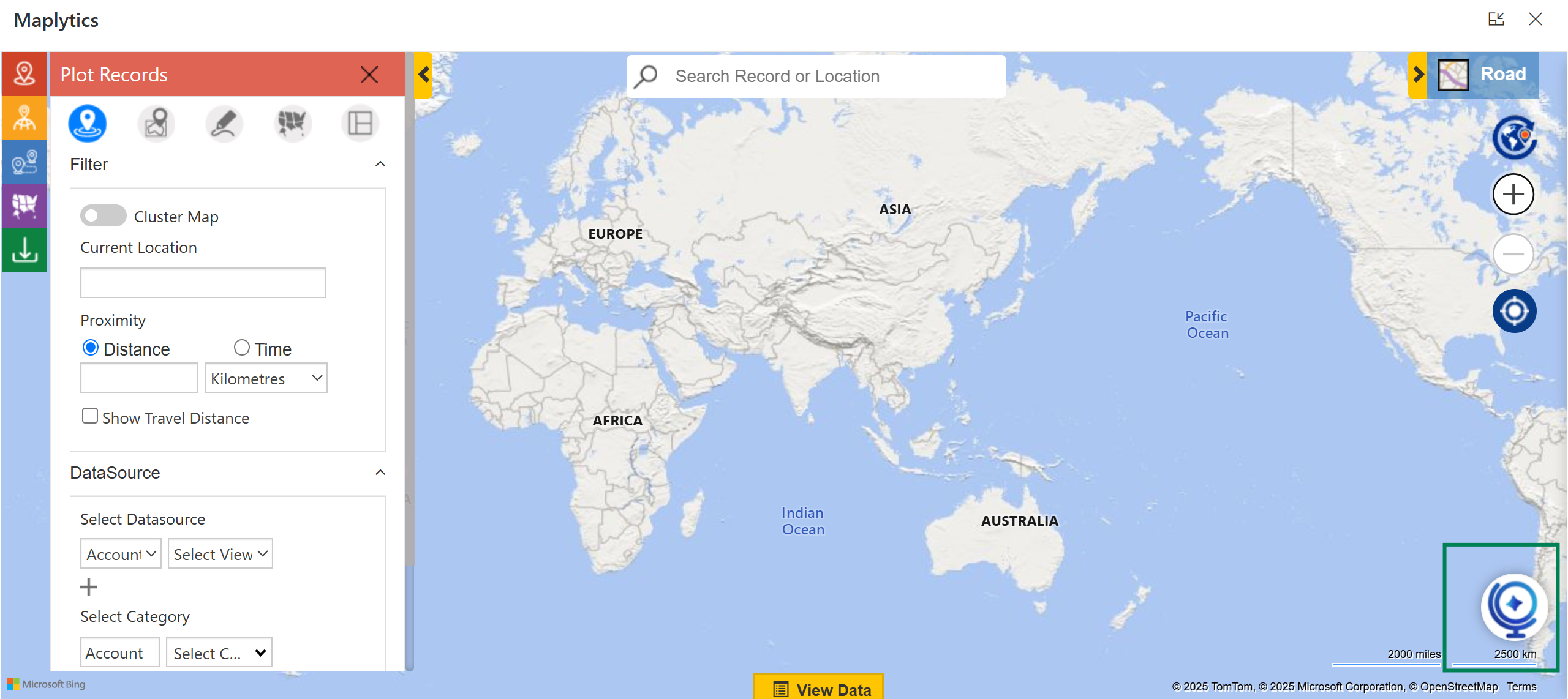 Clicking on the icon opens the MapCopilot window with a few pre-defined prompts. These prompts are associated with the popular/ in-demand features of Maplytics. The prompts given in natural language are converted to machine-readable/ digital language and worked upon.
 You can select any of the prompts and get records plotted on the adjacent map.
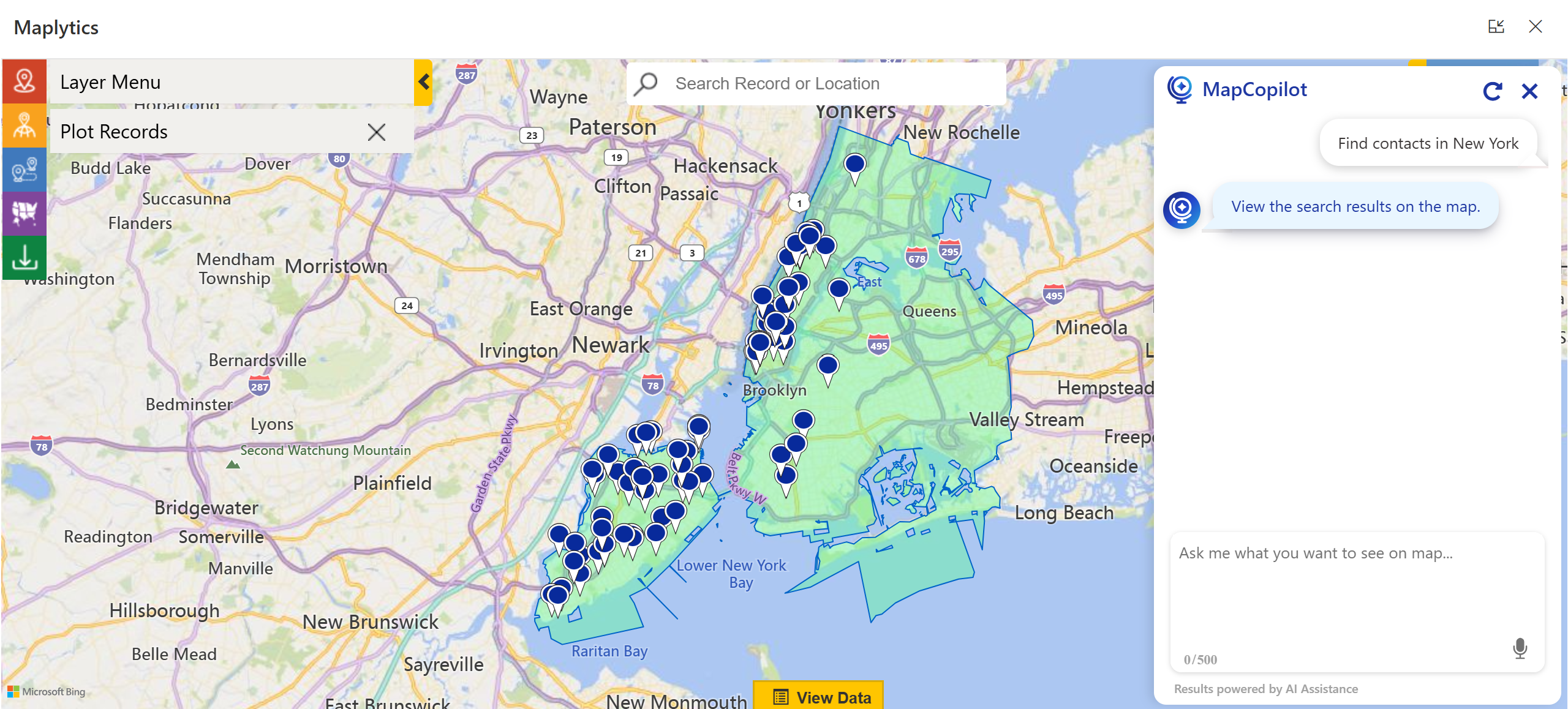 Similarly, in the MapCopilot Panel, you can type in your own queries/prompts. MapCopilot is an interactive AI assistant. So, you can converse with it in continuous prompts. The AI retains the context of the previous prompt and its plotted result. It follows through to the next prompt until the session is active.
A user can move on to a fresh session by clicking on the Refresh icon in the top-right corner.
The MapCopilot window can also be closed by clicking on the Close button next to Refresh. It will, however, retain the previous prompts and their results on the map.
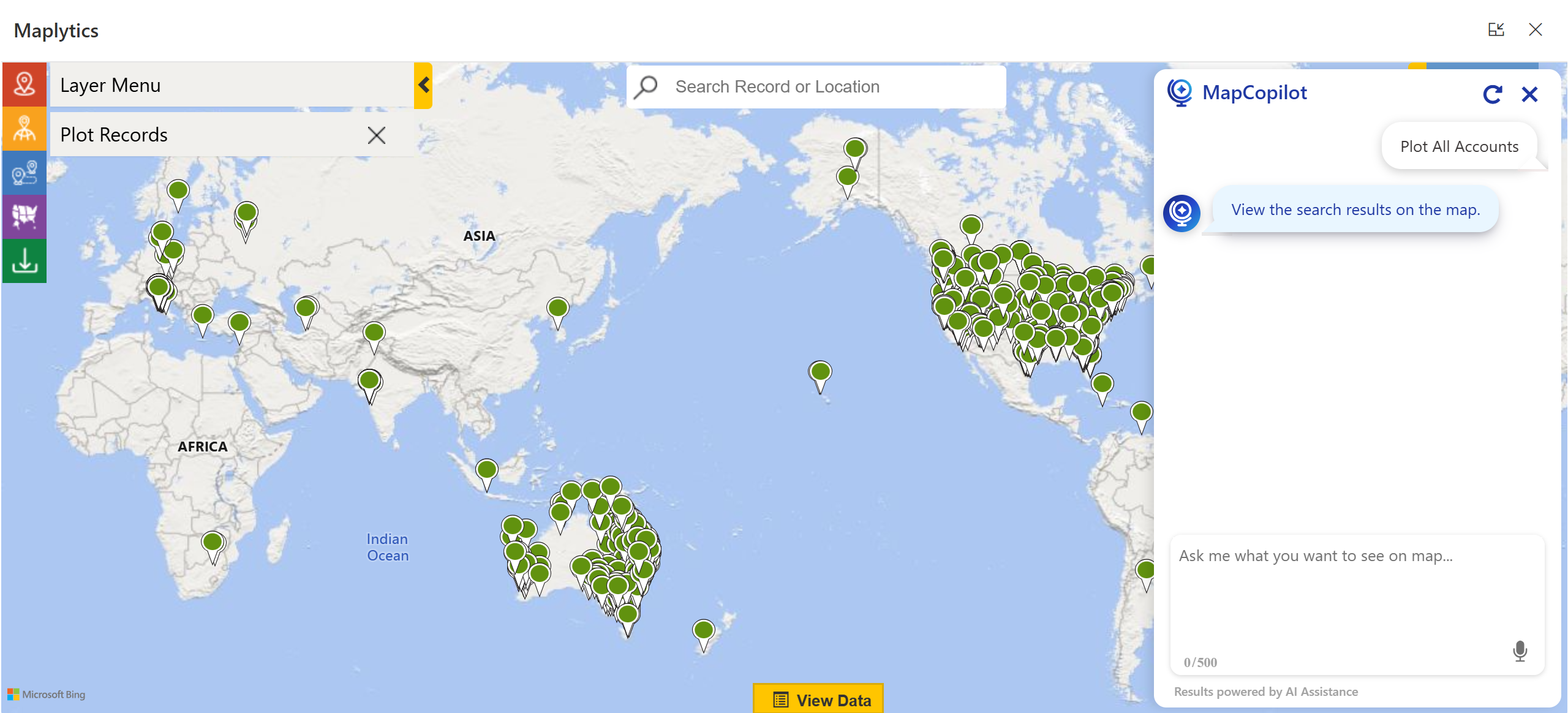
MapCopilot can plot records and help in categorizing them efficiently with prompts in the user’s natural language. The user need not use the Plot Card to select the required data sources and categories to get the desired results. You can start by giving prompts for viewing ‘All Accounts’ and then categorizing them based on, say, Industry, in simple sentences as seen below.
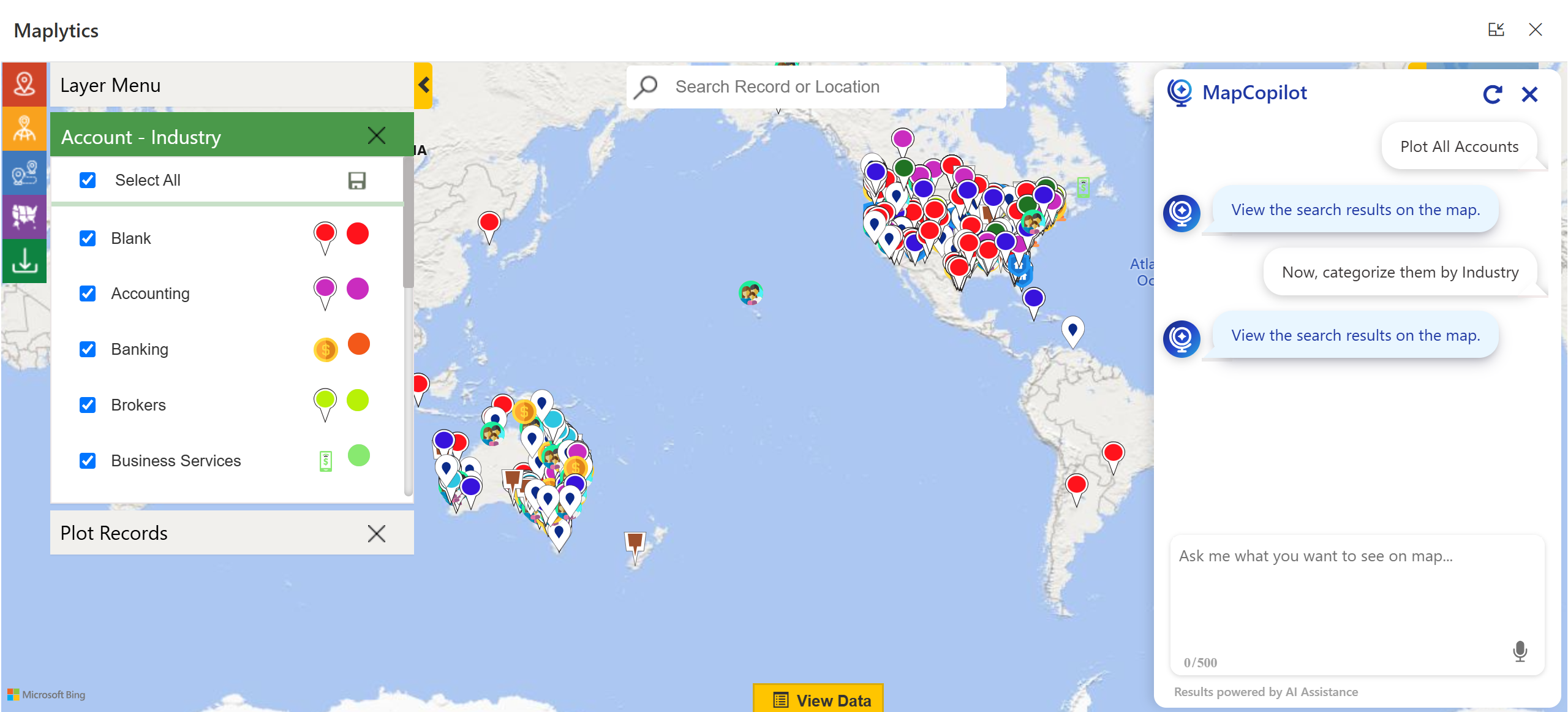 The plotted records can be further categorized based on a particular Industry in the next prompt.
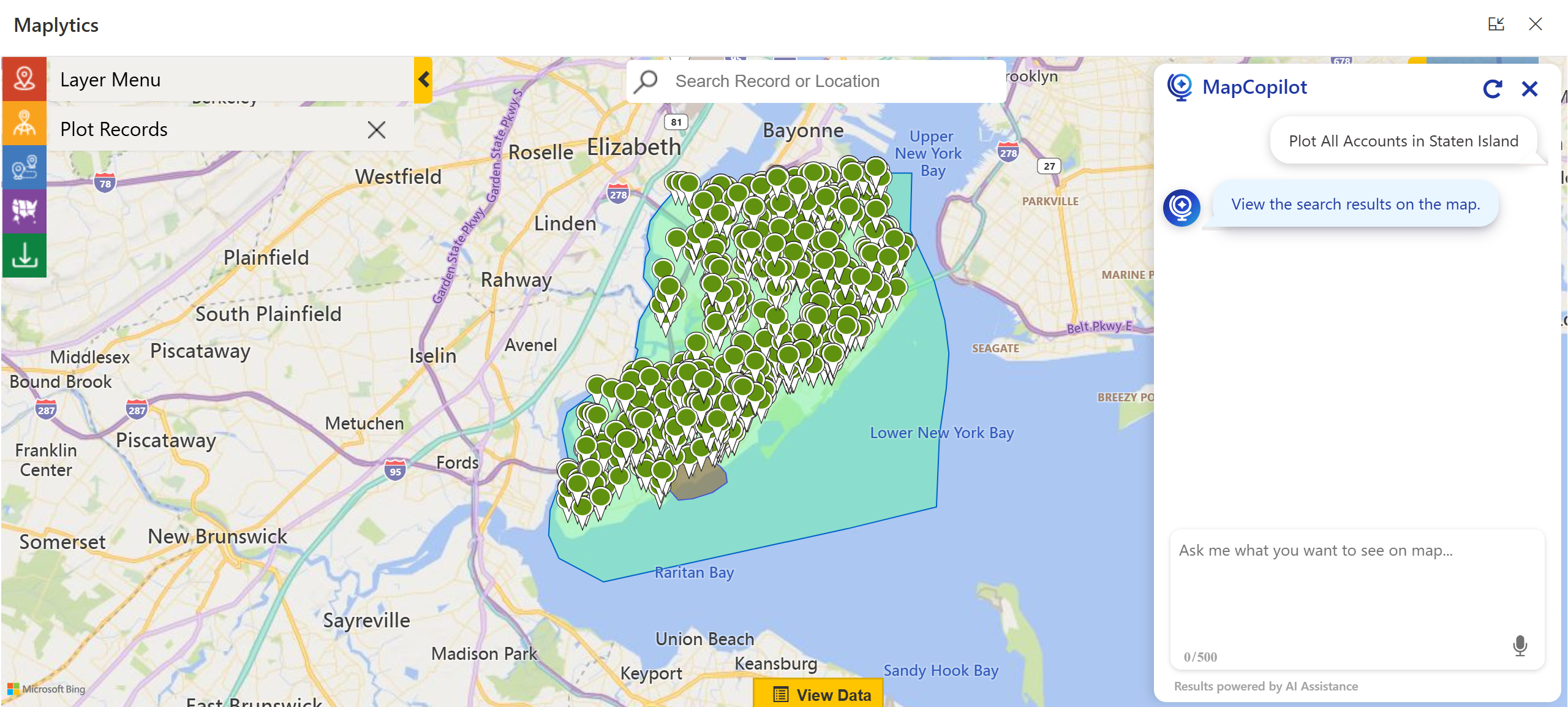
Accounts can also be plotted based on regions by providing appropriate prompts. These prompts save the time required for plotting the same records using the plot card.
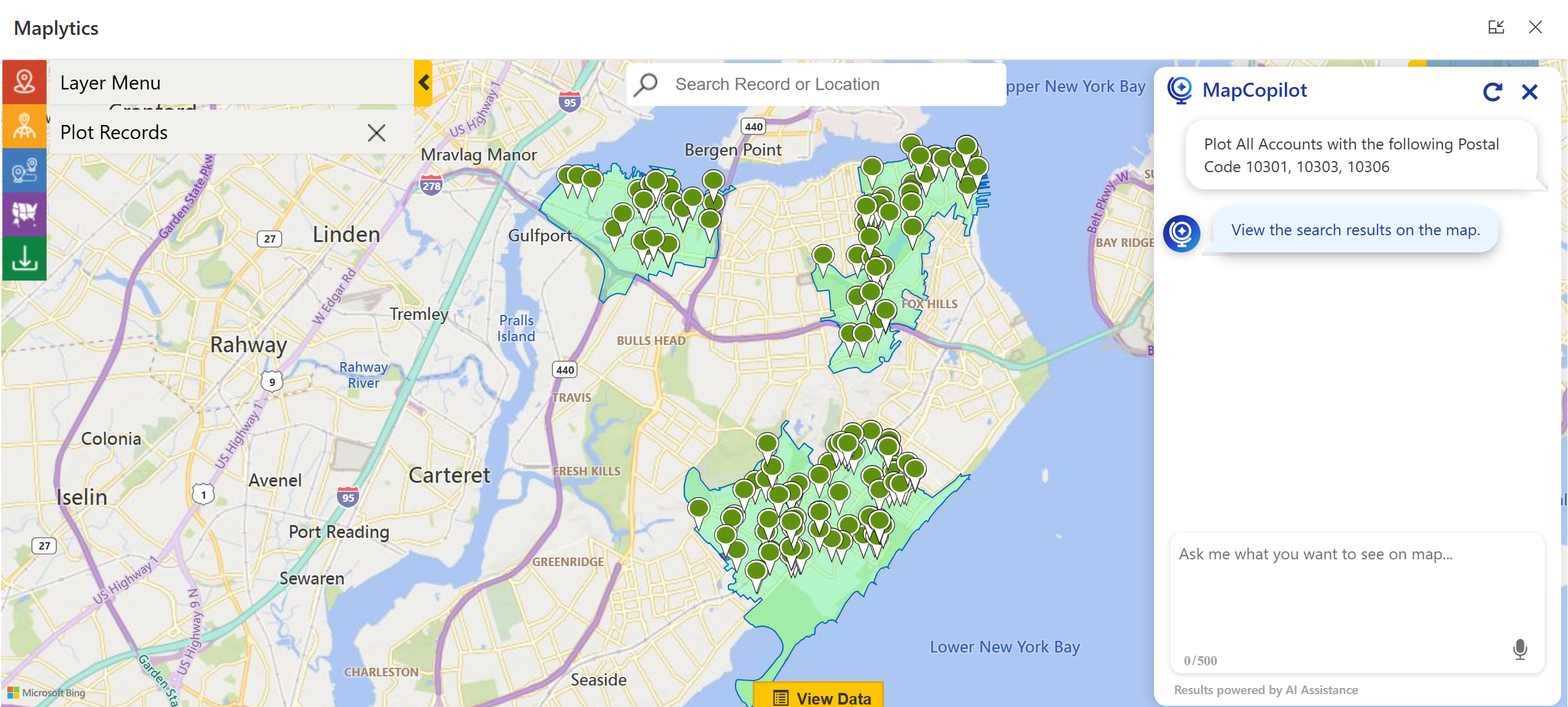
 If you are aware of specific Postal Codes, you can plot records within them as well, using simple prompts.
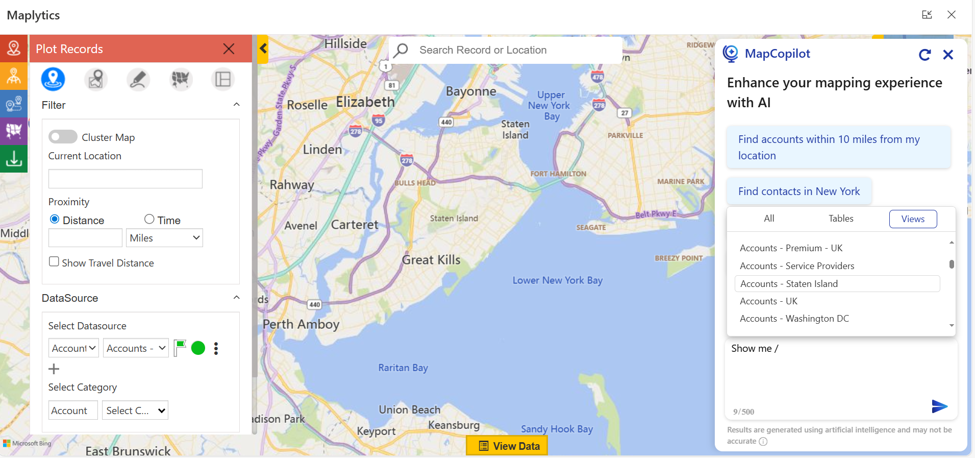
 Users can also view records by adding a ‘slash’ command to the natural language prompt. This list of data sources will appear on the screen, and they can select the required datasource from the ones displayed.
 Click here to see more details.
Radius/ Proximity Search in MapCopilot
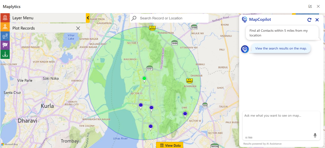
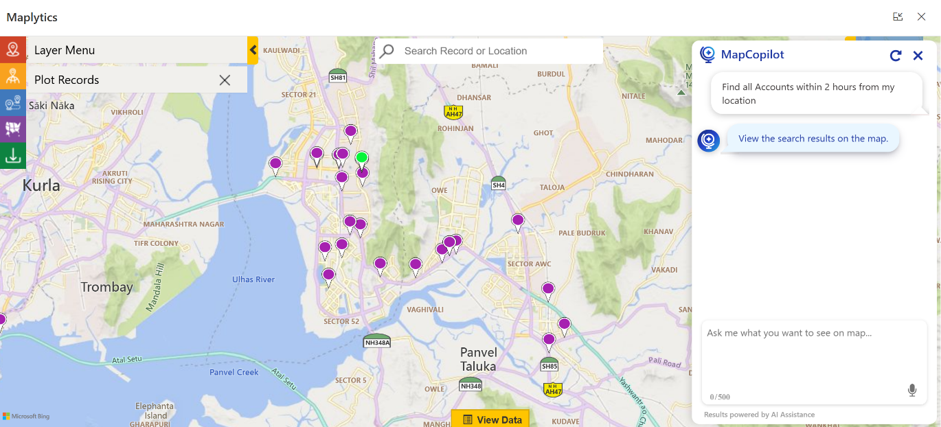
MapCopilot makes finding records nearby, within a specific travel distance or time, faster. Using Radius/ Proximity Search on a plot card requires the user to provide the current location, select radial/ time values, the datasource, and get the desired entity records plotted. With MapCopilot, all of it can be done with a single simple prompt.
All Accounts within a few miles can be plotted quickly.
 Similar record plotting can be done within a specific time.
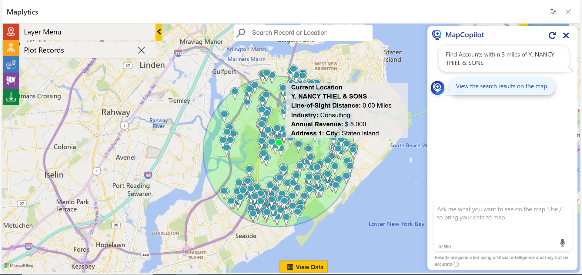
Users can plot Accounts within a specific distance from a particular pushpin as well.
Here, I have plotted accounts within 3 miles of account Y. NANCY THIEL & SONS.
 Route Optimization in MapCopilot
MapCopilot streamlines travel planning with AI-powered, intelligent route optimization. Simply provide a natural language prompt, and it generates the most efficient path to reach the destination. It also supports multi-stop optimized routing and helps field teams save time, reduce fuel costs, and stay on schedule.
The turn-by-turn navigation directions can be followed by the users for an efficient travel experience.
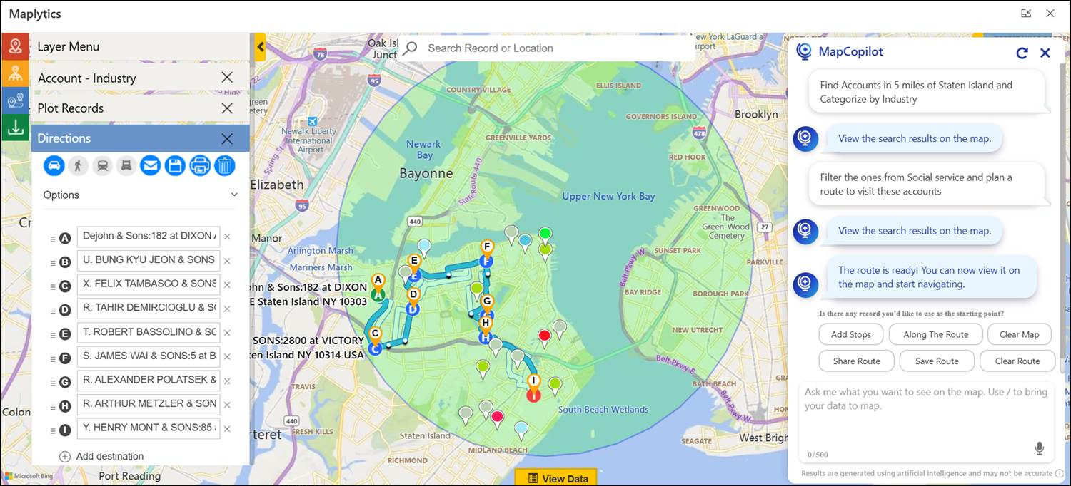
Key Benefits of Route Optimization with MapCopilot also include
- Higher meeting density per day
- Automated rerouting if plans change
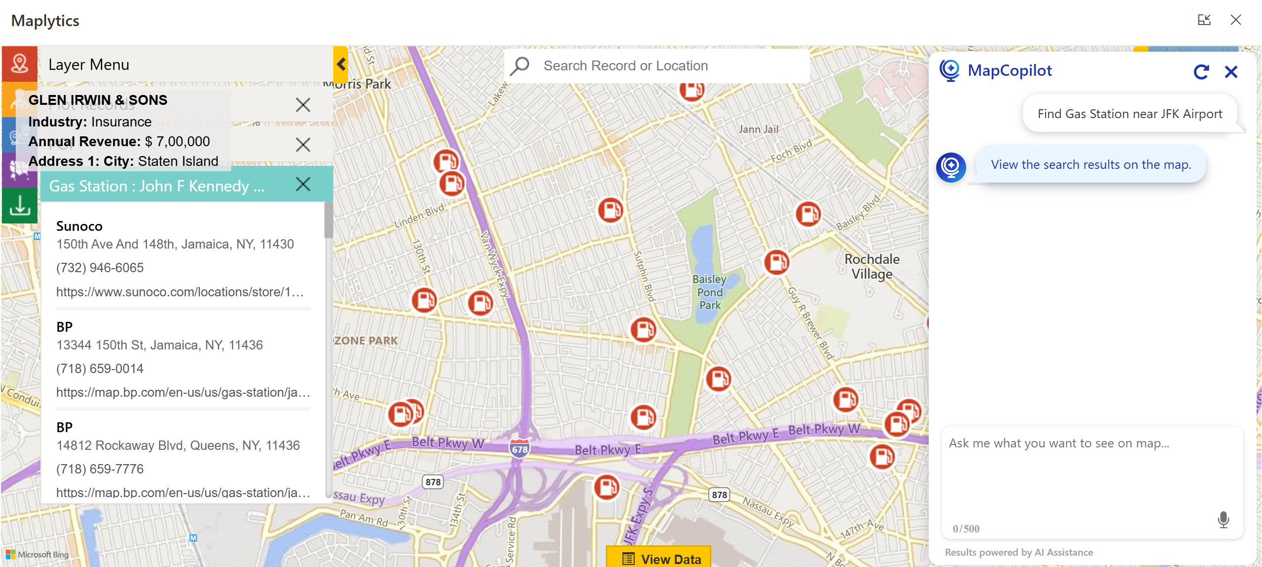
Point Of Interest Location Search in MapCopilot
MapCopilot will support you in finding important locations nearby, such as Airports, Gas Stations, Libraries, Hotels, and more.
 MapCopilot in Mobile Interface
If you are a mobile user, you can open MapCopilot directly from the Dynamics 365 and Power Apps mobile applications.
Advanced Applications in Real World (Use Cases)
Field Service Optimization
A service technician in Orlando can dynamically find urgent jobs near their current assignment. If a cancellation happens, they can fill that time with nearby opportunities identified by MapCopilot, maximizing productivity.
Sales Territory Intelligence
Sales reps can discover high-potential leads around their appointments without manually searching through CRM filters. This boosts lead conversion.
Event Planning & Follow-Ups
After attending an event or conference, teams can instantly find and visit leads near the venue that they met at the event. They can even find meeting spots like a café nearby to meet these new leads.
Smart Decision-Making
MapCopilot isn’t just a query tool but a decision-enabling system. Retaining the context of a conversation allows for continuous back-and-forth.
“Show me all leads in Austin.”
“Filter by Industry = Manufacturing.”
“Optimize a route to visit them.”
The system understands and builds on prior prompts, eliminating the need to reselect filters or redefine parameters each time.
Mobile Experience
MapCopilot isn’t limited to desktop users. It works seamlessly with the Dynamics 365 and Power Apps mobile apps, enabling:
- Real-time mapping on the go
- Route adjustments mid-day
- Instant lead discovery in the field
This makes it a perfect companion for traveling sales teams, service reps, and field strategists.
The Future of AI + Mapping in Dynamics 365
The combination of AI-driven assistants and geospatial intelligence is reshaping how organizations approach data visualization, sales planning, and territory management. By giving users a personal mapping assistant inside Dynamics 365, MapCopilot turns routine CRM tasks into high-impact & fast actions.
To get more acquainted and experience Maplytics & MapCopilot first-hand, one can write to crm@inogic.com.
We can arrange a personalized free demo for your requirements. You can also enjoy a 15-day free trial in your environment.
For applied knowledge, visit our Website or Microsoft AppSource. One can hop onto the detailed Blogs, Client Testimonials, Success Stories, Industry Applications, and Video Library for a quick query resolution. Technical docs for the working of Maplytics are also available for reference.
Kindly leave us a review or write about your experience on AppSource or the G2 Website.